Shapefile - Study guides, Class notes & Summaries
Looking for the best study guides, study notes and summaries about Shapefile? On this page you'll find 43 study documents about Shapefile.
All 43 results
Sort by
-
esri exam 1-30 1. What property of a shapefile should an analyst be aware of when creating statistics from numeric fields?: Shapefiles CANNOT store currency values. 2. A GIS analyst is editing several feature classes associated with city utilities. The an
- Exam (elaborations) • 4 pages • 2023
-
- $10.49
- + learn more
esri exam 1-30 1. What property of a shapefile should an analyst be aware of when creating statistics from numeric fields?: Shapefiles CANNOT store currency values. 2. A GIS analyst is editing several feature classes associated with city utilities. The analyst selects a line feature class that represents the city's gas main, and opens Create Features. By default, which type of features are created?: Polylines 3. An ArcMap user needs to inspect the geometry and attribute schema properties...
-
GIS Final Exam 2024
- Exam (elaborations) • 11 pages • 2024
- Available in package deal
-
- $11.49
- + learn more
GIS Final Exam 2024 The field used to join or relate two tables is called a(n) _____. A)feature ID B)shape ID C)object ID D)key - Answer ️️ -D If you are joining states to counties, with counties as the target table, the cardinality is ____. A)many to one B)one to one C)many to many D)one to many - Answer ️️ -A A relate MUST be used when the cardinality between two tables is ____. A) one-to-one and one-to-many B) many-to-one C) one-to-many D) one-to-one - Answer ️️ -C ...
-
GIS Final Exam 2024
- Exam (elaborations) • 11 pages • 2024
-
- $12.49
- + learn more
GIS Final Exam 2024 The field used to join or relate two tables is called a(n) _____. A)feature ID B)shape ID C)object ID D)key - Answer ️️ -D If you are joining states to counties, with counties as the target table, the cardinality is ____. A)many to one B)one to one C)many to many D)one to many - Answer ️️ -A A relate MUST be used when the cardinality between two tables is ____. A) one-to-one and one-to-many B) many-to-one C) one-to-many D) one-to-one - Answer ️️ -C ...
-
GIS Questions and Answers 2024/2025
- Exam (elaborations) • 11 pages • 2024
-
- $10.69
- + learn more
Spatial data All of the information that can be tied to a specific locations. Data with a geographic location, representation, or reference point that it describes. Visually represented as layers which allow the user to select different sets of data to display the main viewing window in a stacking manner. Cartography The science of mapmaking, including data inclusion, layout, elements, colors, and design. Shapefile A vector data storage format for storing the location, sha...
-
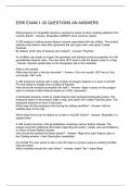
ESRI EXAM 1-30 QUESTIONS AN ANSWERS
- Exam (elaborations) • 4 pages • 2023
-
Available in package deal
-
- $10.49
- + learn more
What property of a shapefile should an analyst be aware of when creating statistics from numeric fields? - Answer- Shapefiles CANNOT store currency values. A GIS analyst is editing several feature classes associated with city utilities. The analyst selects a line feature class that represents the city's gas main, and opens Create Features. By default, which type of features are created? - Answer- Polylines An ArcMap user needs to inspect the geometry and attribute schema properties of a ...
-
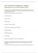
Esri Technical Certification: | Questions and Answers with complete solution
- Exam (elaborations) • 14 pages • 2023
- Available in package deal
-
- $8.19
- + learn more
n ArcGIS user chooses a mobile device to perform a field survey of road damage in an area. The user must obtain various types of information on the damage including surface type, damage, location, and an image of damage to the surface. Which ArcGIS platform application should be used for this task? Drone2Map for ArcGIS Collector for ArcGIS Explorer for ArcGIS ArcGIS App - Collector for ArcGIS What is the default metadata style used by ArcGIS Pro? FGDC CSDGM metadata INSPIRE Metadata Di...
-
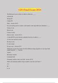
GIS Final Exam 2024 Questions and Answers | 100% Pass
- Exam (elaborations) • 11 pages • 2024
- Available in package deal
-
- $12.49
- + learn more
GIS Final Exam 2024 The field used to join or relate two tables is called a(n) _____. A)feature ID B)shape ID C)object ID D)key - Answer ️️ -D If you are joining states to counties, with counties as the target table, the cardinality is ____. A)many to one B)one to one C)many to many D)one to many - Answer ️️ -A A relate MUST be used when the cardinality between two tables is ____. A) one-to-one and one-to-many B) many-to-one C) one-to-many D) one-to-one - Answer ️️ -C ...
-
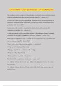
Advanced GIS Exam 1 Questions and Answers 2024 Update
- Exam (elaborations) • 33 pages • 2024
-
- $12.49
- + learn more
Advanced GIS Exam 1 Questions and Answers 2024 Update The coordinate system is a property of the geodatabase, so all feature classes and feature datasets within the geodatabase must share the same coordinate system ToF - Answer ️️ -F You have two feature classes: Parcels and Roads. If you want to use a geodatabase topology to help protect spatial relationships between them, you must store them in a feature dataset in the geodatabase. torf - Answer ️️ -t Schema refers to the structu...
-
esri exam questions with correct answers
- Exam (elaborations) • 6 pages • 2023
- Available in package deal
-
- $14.49
- + learn more
What property of a shapefile should an analyst be aware of when creating statistics from numeric fields? Answer Shapefiles CANNOT store currency values. A GIS analyst is editing several feature classes associated with city utilities. The analyst selects a line feature class that represents the city's gas main, and opens Create Features. By default, which type of features are created? Answer Polylines An ArcMap user needs to inspect the geometry and attribute schema properties of a file g...
-
Advanced GIS Exam 1 Questions and Answers 2024 Update
- Exam (elaborations) • 33 pages • 2024
- Available in package deal
-
- $13.49
- + learn more
Advanced GIS Exam 1 Questions and Answers 2024 Update The coordinate system is a property of the geodatabase, so all feature classes and feature datasets within the geodatabase must share the same coordinate system ToF - Answer ️️ -F You have two feature classes: Parcels and Roads. If you want to use a geodatabase topology to help protect spatial relationships between them, you must store them in a feature dataset in the geodatabase. torf - Answer ️️ -t Schema refers to the structu...

That summary you just bought made someone very happy. Also get paid weekly? Sell your study resources on Stuvia! Discover all about earning on Stuvia


