Topographic - Study guides, Class notes & Summaries
Looking for the best study guides, study notes and summaries about Topographic? On this page you'll find 976 study documents about Topographic.
Page 4 out of 976 results
Sort by
-
Geology Lab Exam II Questions and Answers 2024 with Complete Solution.
- Exam (elaborations) • 15 pages • 2024
-
- $14.99
- + learn more
Geology Lab Exam II Questions and Answers 2024 with Complete Solution. A topographic map has a ratio scale of 1:250,000. One centimeter on the map equals _____ kilometers in the real world. 2.5 Assuming a contour interval of 50 feet, what is the elevation of the centermost contour line in this figure? Please observe that the first contour line has an elevation of 100 feet above sea level. 300 feet Use the Public Land Survey System to locate the X out to three quarters. Assume that it is...
-
MAPPING CERTIFICATION QUESTIONS AND VERIFIED ANSWERS
- Exam (elaborations) • 17 pages • 2024
-
Available in package deal
-
- $11.00
- + learn more
ATTRIBUTE - A TRAIT, QUALITY OR PROPERTY DESCRIDING A GEOGRAPHICAL FEATURE. A FACT DESCRIBING AN ENTITY IN A RELATIONAL DATA MODEL, EQUIVALENT TO THE COLUMN IN A RELATIONAL TABLE ANNOTATION - THE ALPHANUMERIC TEXT OR LABELS ON A MAP SUCH AS A STREET OR PLACE NAME AZIMUTH - THE HORIZONTAL DIRECTION OF A VECTOR, MEASURED CLOCKWISE IN DEGREES OF ROTATION FROM THE POSITIVE Y -AXIS, FOR EXAMPLE, A DEGREES ON A COMPASS BASE MANUSCRIPTS - A SET OF TOPOGRAPHIC DATA DISPLAYED IN MAP FORM PROVID...

-
ASBOG 2021-2025 EXAM REVIEW PRACTICE QUESTIONS AND ANSWERS
- Exam (elaborations) • 16 pages • 2024
- Available in package deal
-
- $11.99
- + learn more
ASBOG EXAM REVIEW PRACTICE QUESTIONS AND ANSWERS What does it mean when you have topographic contours on a 1:24,000 scale base map that are roughly circular and have hachures on the counters? - ANS-They represent a closed depression You have a base map at a scale of 1:6,000 and you need to represent the information you obtained during a field investigation of a site that is one square mile, that included mapping of your site as well as subsurface exploration results. What do you need to...
-
LSIT EXAM 2024 WITH 100% CORRECT ANSWERS
- Exam (elaborations) • 20 pages • 2024
-
- $16.49
- + learn more
LSIT EXAM 2024 WITH 100% CORRECT ANSWERS (i) mathematics, (ii) legal principles, (iii) types of surveys and (iv) survey computations - correct answer Know these forsure Survey Process and Methods - correct answer -Instrumentation (e.g., GNSS/GPS, levels, total stations, robotic total stations, scanners, UAS) -GNSS/GPS surveys (e.g., static, kinematic, OPUS, real-time networks) -Control surveys (e.g., horizontal, vertical, network design, accuracy standards) -Cadastral (e.g., Pub...
-
Topographic Maps Exam Questions with Correct Answers
- Exam (elaborations) • 3 pages • 2024
-
- $7.99
- + learn more
Topographic Maps Exam Questions with Correct Answers Topographic Map - Answer-shows the surface features, or topography of Earth or a certain area. What does a topographic map show? - Answer-it shows natural features such as rivers and lakes. They also show some features made by people such as brodges. They also show elevation. Elevation - Answer-The height of an object above the surface of the sea. What is the elevation at sea level? - Answer-The elevation at sea level is zero meters...
-
Geology Lab Exam II UPDATED ACTUAL Questions and CORRECT Answers
- Exam (elaborations) • 20 pages • 2024
-
- $9.99
- + learn more
Geology Lab Exam II UPDATED ACTUAL Questions and CORRECT Answers A topographic map has a ratio scale of 1:250,000. One centimeter on the map equals _____ kilometers in the real world. - CORRECT ANSWER- 2.5 Assuming a contour interval of 50 feet, what is the elevation of the centermost contour line in this figure? Please observe that the first contour line has an elevation of 100 feet above sea level. - CORRECT ANSWER- 300 feet
-
PRAXIS 5004 EXAM WITH COMPLETE SOLUTIONS GRADED A+
- Exam (elaborations) • 21 pages • 2024
-
Available in package deal
-
- $11.99
- + learn more
PRAXIS 5004 EXAM WITH COMPLETE SOLUTIONS GRADED A+ Mesopotamia - Answer-Ancient civilization that flourished between the Tigris and Euphrates Rivers. Irrigation systems were done resulting in the surplus of food and the beginning of civilization Sumerians - Answer-helped develop the area in Mesopotamia Cuneiform - Answer-Worlds first handwriting system May have also been the first to invent the wheel and plow- mesopotamia Rosetta Stone - Answer-Found in Egypt. Information was written...
-
LSIT Exam Questions & Answers 2024/2025
- Exam (elaborations) • 20 pages • 2024
-
Available in package deal
-
- $9.99
- + learn more
LSIT Exam Questions & Answers 2024/2025 (i) mathematics, (ii) legal principles, (iii) types of surveys and (iv) survey computations - ANSWERSKnow these forsure Survey Process and Methods - ANSWERS-Instrumentation (e.g., GNSS/GPS, levels, total stations, robotic total stations, scanners, UAS) -GNSS/GPS surveys (e.g., static, kinematic, OPUS, real-time networks) -Control surveys (e.g., horizontal, vertical, network design, accuracy standards) -Cadastral (e.g., Public Land Survey S...
-
Topographic Map Exam Questions with Correct Answers
- Exam (elaborations) • 2 pages • 2024
-
- $8.59
- + learn more
Topographic Map Exam Questions with Correct Answers On a topographic map, the difference in elevation between two side-by-side contour lines is called the ___ A. contour interval B. index contour C. depression contour D. hachure - Answer-A. contour interval A point of known elevation on a topographic map is called a/an A. hachure B. contour interval C. topographic profile D. elevation - Answer-C. topographic profile The vertical distance between a given point and the datum plane ...
-
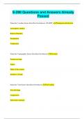
S-290 Questions and Answers Already Passed
- Exam (elaborations) • 23 pages • 2024
-
Available in package deal
-
- $9.99
- + learn more
S-290 Questions and Answers Already Passed Name the 5 weather factors that effect fire behavior. (WARPT) Windspeed and direction Atmospheric stability Relative Humidity Precipitation Temperature Name the 5 topographic factors that affect fire behavior Elevation Position on slope Aspect Shape of the country Steepness of slope Name the 7 fuel factors that effect fire behavior Fuel loading Size and shape Compactness Horizontal continuity Vertical continuity Chemical content Fuel moisture and Fue...

How did he do that? By selling his study resources on Stuvia. Try it yourself! Discover all about earning on Stuvia


