Topographic maps - Study guides, Class notes & Summaries
Looking for the best study guides, study notes and summaries about Topographic maps? On this page you'll find 141 study documents about Topographic maps.
Page 3 out of 141 results
Sort by
-
Basic Appraisal Procedures Study Guide
- Exam (elaborations) • 35 pages • 2024
- Available in package deal
-
- $13.49
- + learn more
Basic Appraisal Procedures Study Guide The appraiser -Answer-Who is responsible for identifying the intended use of an appraisal? Valuation process -Answer-A step-by-step procedure that can be applied to any type of appraisal assignment. No -Answer-Does an appraiser's client always have to directly engage him? False -Answer-The effective date of the valuation must be the date on which the appraiser inspected the subject property. Maximally productive -Answer-In highest and best use anal...
-
ASBOG 2021-2025 EXAM REVIEW PRACTICE QUESTIONS AND ANSWERS
- Exam (elaborations) • 16 pages • 2024
- Available in package deal
-
- $11.99
- + learn more
ASBOG EXAM REVIEW PRACTICE QUESTIONS AND ANSWERS What does it mean when you have topographic contours on a 1:24,000 scale base map that are roughly circular and have hachures on the counters? - ANS-They represent a closed depression You have a base map at a scale of 1:6,000 and you need to represent the information you obtained during a field investigation of a site that is one square mile, that included mapping of your site as well as subsurface exploration results. What do you need to...
-
IEB/NSC - Geo - Geomorphology
- Summary • 16 pages • 2023
-
- $5.71
- 1x sold
- + learn more
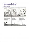
This summary cover the following topics for Grade 12 Geomorphology: Drainage Systems in South Africa • important concepts: drainage basin, catchment area, river system, watershed, tributary, river mouth, source, confluence, water table, surface run-off and groundwater • types of rivers: permanent, periodic, episodic and exotic • drainage patterns: dendritic, trellis, rectangular, radial, centripetal, deranged and parallel • drainage density • stream order • use of topographi...
-
AP Human Geography Chapter 1 Multiple Choice Test Solved 100%
- Exam (elaborations) • 11 pages • 2023
- Available in package deal
-
- $10.49
- 1x sold
- + learn more
Which of the following statements is most correct regarding the origins of geography? A. Geography was invented as a science in the late 18th century. B. Physical geography has been studied since ancient times but human geography was first studied in the 20th century. C. Geographers owes its existence to the Renaissance period in western Europe. D. Humans have practice similar geography at least since time of ancient Greek civilization. E. Human geography was not practice until powerful...
-
BCIA Test Prep - Technical Foundations of Neurofeedback - Tom Collura
- Exam (elaborations) • 25 pages • 2024
-
- $10.99
- + learn more
BCIA Test Prep - Technical Foundations of Neurofeedback - Tom Collura EEG - Correct Answer Electroencephalography - Technique by which the brain's electrical activity is recorded by the use of sensors and amplifiers. - First used by Hans Berger in 1932. Quantitative EEG - Correct Answer - Technique in which EEG recordings are computer-analyzed to produce numbers referred to as "metrics" used to guide decision-making and therapeutic planning. - Typically involves raw numbers, statistics...
-
ILTS 163 LATEST 2024 EXAM QUESTIONS AND REVISED ANSWERS (ALL ARE CORRECT) NEWEST UPDATE
- Exam (elaborations) • 24 pages • 2024
-
- $12.99
- + learn more
ILTS 163 LATEST 2024 EXAM QUESTIONS AND REVISED ANSWERS (ALL ARE CORRECT) NEWEST UPDATE List physical geographic features of the earth that student would have to know to perform well in National geographic Bee - Answer- -continents -5 major oceans -highest and lowest point on each continent (Mt. Everest-highest, Dead Sea-lowest) -10 largest seas (Coral sea is the largest) -10 largest lakes (largest- captain Lake) -10 largest Islands (Greenland- largest) -Longest river (Nile) -major Mou...
-
Surveying Final Exam Questions With Complete Solutions
- Exam (elaborations) • 20 pages • 2023
-
- $13.49
- + learn more
Control Survey: Lambert Projection correct answer: An imaginary cone is placed around the earth so that the apex of the cone is on the earth's axis of rotation above the North Pole, for northern hemisphere and below the South Pole for southern hemisphere projections. East west direction is relatively free from distortion in this method. Therefore, states longer in east-west direction are projected with this system, Scale is set for 158 miles of N/S distance in this method. Transverse Merc...

-
Science Olympiad - Dynamic Planet Latest Update Graded A+
- Exam (elaborations) • 22 pages • 2024
- Available in package deal
-
- $9.99
- + learn more
Science Olympiad - Dynamic Planet Latest Update Graded A+ USGS topographic maps detailed record of a land area, giving geographic positions and elevations for both natural and man-made features. They show the shape of the land the mountains, valleys, and plains by means of brown contour lines stream order The concept that describes the hierarchy of stream types (see image) Perennial streams Water flows in the stream at least 90 percent of the time in a well defined channel. Int...

-
Tactical Tools (Corporal's Course) Exam Questions and Answers 100% Pass
- Exam (elaborations) • 73 pages • 2024
- Available in package deal
-
- $13.49
- + learn more
Tactical Tools (Corporal's Course) Exam Questions and Answers 100% Pass A map is defined as - Answer- a graphic representation of a portion of the Earth's surface drawn to scale, as seen from above. It uses colors, symbols, and labels to represent features found on the ground. -The ideal representation would be realized if every feature of the area being mapped could be shown in true shape. -The purpose of a map is to provide information on the existence, location, and distance between...

-
Intro to Geology - Exam 1 exam questions and answers 2024
- Exam (elaborations) • 11 pages • 2024
-
- $17.49
- + learn more
What is Geology? Geology is the study of the earth, including the earth's composition, structure and the processes that have shaped it What geologic factors influence people? Mountains and valleys, volcanoes, faults and earthquakes, rivers, climate, natural resources What are the three natural resources? Minerals, oil, water How are populations influenced by geology? Low populations tend to live in extreme terrain where places of high population are usually on flat land...

How did he do that? By selling his study resources on Stuvia. Try it yourself! Discover all about earning on Stuvia


