Topographic maps Study guides, Class notes & Summaries
Looking for the best study guides, study notes and summaries about Topographic maps? On this page you'll find 132 study documents about Topographic maps.
Page 2 out of 132 results
Sort by
-
PRAXIS 5004 EXAM WITH COMPLETE SOLUTIONS GRADED A+
- Exam (elaborations) • 21 pages • 2024
-
Available in package deal
-
- $11.99
- + learn more
PRAXIS 5004 EXAM WITH COMPLETE SOLUTIONS GRADED A+ Mesopotamia - Answer-Ancient civilization that flourished between the Tigris and Euphrates Rivers. Irrigation systems were done resulting in the surplus of food and the beginning of civilization Sumerians - Answer-helped develop the area in Mesopotamia Cuneiform - Answer-Worlds first handwriting system May have also been the first to invent the wheel and plow- mesopotamia Rosetta Stone - Answer-Found in Egypt. Information was written...
-
Topographic Maps Test Questions with Correct Answers
- Exam (elaborations) • 2 pages • 2024
-
- $5.79
- + learn more
Topographic Maps Test Questions with Correct Answers Mapmakers use contour lines to represent what three things on topographic maps? - Answer-elevation, relief, and slope contour line - Answer-A contour line on a topographic map connects points of equal elevation. contour interval - Answer-The change in elevation from contour line to contour line is called the contour interval. index contours - Answer-Every fifth line, known as the index contour, is darker and heavier than the others...
-
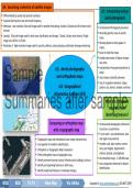
Grade 12 Geography Summaries Topic 1 & 2 (Term 1) - Via Afrika
- Summary • 78 pages • 2024
-
- $8.89
- + learn more
Grade 12 Geography Summaries Topic 1 & 2 (Term 1). This summaries are composed using the Via Afrika textbooks' work with examples and supplementary notes. This product also contains the summaries for Geographic skills and Techniques (Terms 1 - 4). Contents: Geographical Skills and Techniques: * Mapwork techniques. * Topographic maps. * Aerial photographs and orthophoto maps. * Geographic Information Systems (GIS). * Using atlases. Topic 1: Climate and W...
-
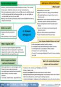
Grade 12 Geography Summaries Skills & Techniques plus Topic 1 & 2 (Term 1) - Via Afrika
- Summary • 72 pages • 2024
-
- $8.89
- + learn more
Grade 12 Geography Summaries Topic 1 & 2 (Term 1). This summaries are composed using and combining the Via Afrika textbooks' work with examples and supplementary notes. This product also contains the summaries for Geographic skills and Techniques (Terms 1 - 4). Contents: Geographical Skills and Techniques: Mapwork techniques. Topographic maps. Aerial photographs and orthophoto maps. Geographic Information Systems (GIS). Using atlases. Topic 1: Climate and Weather Mid-latit...
-
AP Human Geography Chapter 1 Multiple Choice Test Solved 100%
- Exam (elaborations) • 11 pages • 2023
- Available in package deal
-
- $10.49
- 1x sold
- + learn more
Which of the following statements is most correct regarding the origins of geography? A. Geography was invented as a science in the late 18th century. B. Physical geography has been studied since ancient times but human geography was first studied in the 20th century. C. Geographers owes its existence to the Renaissance period in western Europe. D. Humans have practice similar geography at least since time of ancient Greek civilization. E. Human geography was not practice until powerful...
-
UCLA EPSS 61 Final Questions And Answers Rated A+ New Update Assured Satisfaction
- Exam (elaborations) • 11 pages • 2024
- Available in package deal
-
- $7.99
- + learn more
Define Geologic Map - A record of the locations, orientations, and relationships between bodies of rock and geologic structures. List the three things that all maps must convey - 1: The Location of the map 2: The Orientation of the map 3: The Scale of the map Explain how latitude and longitude define a point on Earth's surface - Any point on Earth can be defined by the intersection of its lines of latitude and longitude. Latitude is the flat horizontal lines (flatitude) and longitude are...
-
Topographic Maps Exam Questions with Correct Answers
- Exam (elaborations) • 3 pages • 2024
-
- $7.99
- + learn more
Topographic Maps Exam Questions with Correct Answers Topographic Map - Answer-shows the surface features, or topography of Earth or a certain area. What does a topographic map show? - Answer-it shows natural features such as rivers and lakes. They also show some features made by people such as brodges. They also show elevation. Elevation - Answer-The height of an object above the surface of the sea. What is the elevation at sea level? - Answer-The elevation at sea level is zero meters...
-
Staff Sergeant Board Pari Test Questions and Answers
- Exam (elaborations) • 9 pages • 2024
-
Available in package deal
-
- $12.99
- + learn more
Staff Sergeant Board Pari Test Questions and Answers What is a map? (TC 3-25.26) - Answer-A map is a graphic representation of a portion of the earth's surface drawn to scale, as seen from above What are the five major terrain features? (TC 3-25.26) - Answer-Hill, Valley, Ridge, Saddle, Depression (use "Hidden Valley Ranch Salad Dressing" to remember these ones) What are the two techniques for using the lensatic compass? (TC 3-25.26) - Answer-1. Center hold technique 2. Compass-to-c...
-
Basic Appraisal Procedures Study Guide
- Exam (elaborations) • 35 pages • 2024
- Available in package deal
-
- $13.49
- + learn more
Basic Appraisal Procedures Study Guide The appraiser -Answer-Who is responsible for identifying the intended use of an appraisal? Valuation process -Answer-A step-by-step procedure that can be applied to any type of appraisal assignment. No -Answer-Does an appraiser's client always have to directly engage him? False -Answer-The effective date of the valuation must be the date on which the appraiser inspected the subject property. Maximally productive -Answer-In highest and best use anal...
-
Land Navigation (ARMY BOARD) Questions and Answers Already Passed
- Exam (elaborations) • 6 pages • 2024
-
- $8.99
- + learn more
Land Navigation (ARMY BOARD) Questions and Answers Already Passed TC that covers Land Navigaiton TC 3-25.26 What are the five major terrain features? 1. Hill 2. Valley 3. Ridge 4. Saddle 5. Depression What is the first step to navigation? Orienting the map What are the supplementary terrain features? 1. Cut 2. Fill What are the three minor terrain features? 1. Draw 2. Cliff 3. Spur What are contour lines and what do they represent? A contour line represents an imagi...

Do you wonder why so many students wear nice clothes, have money to spare and enjoy tons of free time? Well, they sell on Stuvia! Imagine your study notes being downloaded a dozen times for $15 each. Every. Single. Day. Discover all about earning on Stuvia


