Latitude coordinate range - Study guides, Class notes & Summaries
Looking for the best study guides, study notes and summaries about Latitude coordinate range? On this page you'll find 44 study documents about Latitude coordinate range.
Page 2 out of 44 results
Sort by
-
METEOROLOGY ATSC 110 EXAM | QUESTIONS & ANSWERS (VERIFIED) | LATEST UPDATE | GRADED A+
- Exam (elaborations) • 27 pages • 2024
-
- $13.49
- + learn more
1 METEOROLOGY ATSC 110 EXAM | QUESTIONS & ANSWERS (VERIFIED) | LATEST UPDATE | GRADED A+ What is the primary source of energy for the earth's atmosphere? Correct Answer: the sun List the two most abundant permanent gases in today's atmosphere. Correct Answer: 1.Nitrogen (N2) 78.08% 2.Oxygen (O2) 20.95% When looking at the variable gases in our atmosphere, which one shows the greatest variation at the earth's surface? Correct Answer: Water Vapor varies greatly from place to place...
-
ESRI Technical Certification Arcgis Desktop Questions And Answers Latest Top Score.
- Exam (elaborations) • 4 pages • 2024
-
- $11.49
- + learn more
ESRI Technical Certification Arcgis Desktop Questions And Answers Latest Top Score. An ArcGIS user chooses a mobile device to perform a field survey of road damage in an area. The user must obtain various types of information on the damage including surface type, damage, location, and an image of damage to the surface. Which ArcGIS platform application should be used for this task? - correct answer. Collector for ArcGIS What is the default metadata style used by ArcGIS Pro? - ...
-
Introduction to Physcial and Human Geography D199 Questions & Answers(RATED A)
- Exam (elaborations) • 15 pages • 2024
-
- $11.99
- + learn more
What are maps used for? -ANSWER - show an area larger than a person can see - present information concisely, especially the features of most interest to the user - demonstrate spatial relationships - show things people cannot see directly, such as minerals below ground or records of daily temperatures. Reference map -ANSWER - store data and show a variety of features for a variety of uses. - general storehouses of information Thematic maps -ANSWER - highlight specific themes -goal is ...
-
GIS Questions and Answers Already Passed
- Exam (elaborations) • 16 pages • 2023
- Available in package deal
-
- $9.99
- + learn more
GIS Questions and Answers Already Passed What is GIS A system with spatially referenced data with meaning behind the data using explicit links. What questions are unique to geography and therefore GIS? questions related to trends, location, conditions etc Why is GIS called an "enabling technology"? because you can use it with several different disciplines. What industry is the biggest spender on GIS and why? Utility companies because they need their databases current and up to date. What i...
-
WGU C255 EXAM 2023 QUESTIONS AND ANSWERS ALL CORRECT
- Exam (elaborations) • 11 pages • 2023
-
Available in package deal
-
- $11.89
- + learn more
WGU C255 EXAM 2023 QUESTIONS AND ANSWERS ALL CORRECT Geography - CORRECT ANSWERS the study of the interaction of all physical and human phenomena at individual places and of how interactions among places form patterns and organize larger spaces. 5 themes of geography - CORRECT ANSWERS 1. Location 2. Place 3. Human-Environment Interaction 4. Movement 5. Region Location - CORRECT ANSWERS Refers to the physical presenc...
-
GROL Element 3: Complete Study Guide and Practice Questions for General Radiotelephone Operator License
- Exam (elaborations) • 43 pages • 2024
-
- $7.99
- + learn more
GROL Element 3: Complete Study Guide and Practice Questions for General Radiotelephone Operator License The product of the readings of an AC voltmeter and AC ammeter is called: Apparent power What is the term used to express the amount electrical energy stored in an electrostatic field? Joules What formula would determine the inductive reactance of a coil if frequency and coil inductance is known? Xl=2pi(fL) What determines the strength of a magnetic field around a conductor? The am...
-
AP Human Geography: Geography (2022/2023) Graded A
- Exam (elaborations) • 12 pages • 2023
-
Available in package deal
-
- $9.99
- + learn more
AP Human Geography: Geography (2022/2023) Graded A space geometric surface of the Earth place an area of bounded space of some human importance region a type of place toponym a place name sequent occupancy the succession of groups and cultural influences throughout a place's history place-specific culture ex. Sante Fe, Mexico, a complex mix of multiple Native American, Spanish colonial, and modern American influences based upon the sequence of past and current societal influences scale re...
-
PreCal B - Unit 2 The Trigonometry of Temperatures Portfolio Modified S2021
- Exam (elaborations) • 6 pages • 2023
-
- $9.49
- + learn more
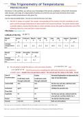
Directions: In this portfolio, you will use your knowledge of the period, amplitude, vertical shift, horizontal shift, domain, and range of a trigonometric functions to write the sine and cosine functions that model average monthly temperatures in the given city. Use the data provided below. You do not need to find your own data. 1. Plot the 12 values on a graph. The number corresponding to the month is the first coordinate of each point, and the average temperature for that month is the se...
-
TEST – ITEM BANK FOR DECK OFFICER AT MANAGEMENT LEVEL
- Exam (elaborations) • 698 pages • 2024
-
- $15.19
- + learn more
TEST – ITEM BANK FOR DECK OFFICER AT MANAGEMENT LEVEL CONTENTS II. DECK OFFICERS COMPETENCE (PART II) ............................................................................ 1 1. Plan a voyage and conduct navigation ........................................................................ 1 2. Determine position and the accuracy of resultant position fix by any means ...............................................
-
GIS Final Exam with Correct Answers Graded A
- Exam (elaborations) • 5 pages • 2023
-
- $10.99
- + learn more
What does GIS stand for? - Geographic information system Given a good definition for GIS, list the four components and put a star next to the most important one - software, hardware, spatial data, people* List four things GIS can do - enter data, store/display data, analyze data, manipulate data Name the two general types/kind of data - attribute and spatial example of spatial data - spaulding hall, room 217, UNH, Durham NH example of attribute data - there are 30 cats in a vetern...

Did you know that on average a seller on Stuvia earns $82 per month selling study resources? Hmm, hint, hint. Discover all about earning on Stuvia


