Autocad practice exam Study guides, Class notes & Summaries
Looking for the best study guides, study notes and summaries about Autocad practice exam? On this page you'll find 20 study documents about Autocad practice exam.
Page 2 out of 20 results
Sort by
-
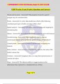
GISP Practice Exam Graded A+
- Exam (elaborations) • 4 pages • 2024
-
Available in package deal
-
- $9.89
- + learn more
GISP Practice Exam Graded A+ Key Terms and Definitions - Precise and Accurate: The property indicating that the area for a parcel polygon in GIS may be considered both accurate and precise. - Points: In a vector data model, points utilize coordinate pairs to represent curvature within a line. - Spatial Analysis: GIS differentiates itself from traditional surveying and mapping by introducing spatial analysis techniques. - Datum: A mathematical model that relates to real-world features and d...
-
GISP Practice Exam Questions and Answers 2023 with complete solution
- Exam (elaborations) • 3 pages • 2023
-
Available in package deal
-
- $10.49
- + learn more
GISP Practice Exam Questions and Answers 2023 with complete solution Precise and accurate The property of area for a parcel polygon may be considered this: Points A vector data model uses which of the following coordinate pair types to build curvature within a line? Spatial analysis GIS differs from surveying and mapping by introducing this: Datum The mathematical model related to real world features Georeferencing Which method is used to align an unreferenced dataset with one that h...
-
GISP Practice Exam Questions and Answers Already Passed
- Exam (elaborations) • 6 pages • 2023
- Available in package deal
-
- $9.99
- + learn more
GISP Practice Exam Questions and Answers Already Passed The property of area for a parcel polygon may be considered this: Precise and accurate A vector data model uses which of the following coordinate pair types to build curvature within a line? Points GIS differs from surveying and mapping by introducing this: Spatial analysis The mathematical model related to real world features Datum Which method is used to align an unreferenced dataset with one that has spatial reference information? Ge...
-
Autodesk Certified Professional in AutoCAD for Design and Drafting Exam Study Set Qs & As
- Exam (elaborations) • 10 pages • 2024
-
Available in package deal
-
- $10.99
- + learn more
Autodesk Certified Professional in AutoCAD for Design and Drafting Exam Study Set Which method allows multiple grips to be selected simultaneously? - Answer- Select them while holding down the Shift key. When grip editing an object with dynamic input enabled, what does the small lock icon next to the highlighted value indicate? - Answer- The object is constrained by a previously entered value. When drawing a line with dynamic input enabled, how do you toggle between the displayed values...
-
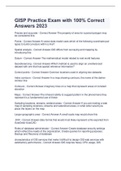
GISP Practice Exam with 100% Correct Answers 2023
- Exam (elaborations) • 3 pages • 2023
-
- $10.49
- + learn more
GISP Practice Exam with 100% Correct Answers 2023 Precise and accurate - Correct Answer-The property of area for a parcel polygon may be considered this: Points - Correct Answer-A vector data model uses which of the following coordinate pair types to build curvature within a line? Spatial analysis - Correct Answer-GIS differs from surveying and mapping by introducing this: Datum - Correct Answer-The mathematical model related to real world features Georeferencing - Correct Answer-Which ...
-
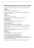
GISP Exam Questions and Answers 2023
- Exam (elaborations) • 13 pages • 2023
-
- $11.99
- + learn more
GISP Exam Questions and Answers 2023 The property of area for a parcel polygon may be considered (choose best answer) A. Precise B. Accurate C. Legally correct D. Both A and B - Correct Answer-Both A and B A vector data model uses which of the following coordinate pairs to build curvature within a line? (best answer) A. Verticies B. Points C. Floating points D. Nodes - Correct Answer-A. Verticies GIS differs from surveying and mapping by introducing (best answer) A. Attribute descri...
-
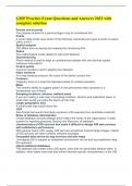
GISP Practice Exam Questions and Answers 2023 with complete solution
- Exam (elaborations) • 3 pages • 2023
-
Available in package deal
-
- $10.49
- + learn more
GISP Practice Exam Questions and Answers 2023 with complete solution Precise and accurate The property of area for a parcel polygon may be considered this: Points A vector data model uses which of the following coordinate pair types to build curvature within a line? Spatial analysis GIS differs from surveying and mapping by introducing this: Datum The mathematical model related to real world features Georeferencing Which method is used to align an unreferenced dataset with one that h...
-
GISP Practice Exam Practice Questions and Answers
- Exam (elaborations) • 5 pages • 2024
-
- $8.99
- + learn more
GISP Practice Exam Practice Questions and Answers Precise and accurate - Answer️️ -The property of area for a parcel polygon may be considered this: Points - Answer️️ -A vector data model uses which of the following coordinate pair types to build curvature within a line? Spatial analysis - Answer️️ -GIS differs from surveying and mapping by introducing this: Datum - Answer️️ -The mathematical model related to real world features Georeferencing - Answer️️ -Which method...
-
GISP Practice Exam Questions and Answers 2024 with complete solution
- Exam (elaborations) • 3 pages • 2024
-
- $11.49
- + learn more
GISP Practice Exam Questions and Answers 2024 with complete solution Precise and accurate - answerThe property of area for a parcel polygon may be considered this: Points - answerA vector data model uses which of the following coordinate pair types to build curvature within a line? Spatial analysis - answerGIS differs from surveying and mapping by introducing this: Datum - answerThe mathematical model related to real world features Georeferencing - answerWhich method is used to align an ...
-
GISP Practice Exam with 100% Correct Answers 2023
- Exam (elaborations) • 3 pages • 2023
-
- $10.49
- + learn more
GISP Practice Exam Precise and accurate - Correct Answer-The property of area for a parcel polygon may be considered... Vertices - Correct Answer-A vector data model uses which of the following coordinate pair types to build curvature within a line? Spatial analysis - Correct Answer-GIS differs from surveying and mapping by introducing Datum - Correct Answer-Real-world features projected with minimum distortion from a round earth to flat map Georeferencing - Correct Answer-Which method ...

Study stress? For sellers on Stuvia, these are actually golden times. KA-CHING! Earn from your study resources too and start uploading now. Discover all about earning on Stuvia


