Topographic - Study guides, Class notes & Summaries
Looking for the best study guides, study notes and summaries about Topographic? On this page you'll find 980 study documents about Topographic.
Page 3 out of 980 results
Sort by
-
Topographic Maps Test Questions with Correct Answers
- Exam (elaborations) • 2 pages • 2024
-
- $5.79
- + learn more
Topographic Maps Test Questions with Correct Answers Mapmakers use contour lines to represent what three things on topographic maps? - Answer-elevation, relief, and slope contour line - Answer-A contour line on a topographic map connects points of equal elevation. contour interval - Answer-The change in elevation from contour line to contour line is called the contour interval. index contours - Answer-Every fifth line, known as the index contour, is darker and heavier than the others...
-
Grade 12 Geography Summaries Topic 1 & 2 (Term 1) - Via Afrika
- Summary • 78 pages • 2024
-
- $8.48
- + learn more
Grade 12 Geography Summaries Topic 1 & 2 (Term 1). This summaries are composed using the Via Afrika textbooks' work with examples and supplementary notes. This product also contains the summaries for Geographic skills and Techniques (Terms 1 - 4). Contents: Geographical Skills and Techniques: * Mapwork techniques. * Topographic maps. * Aerial photographs and orthophoto maps. * Geographic Information Systems (GIS). * Using atlases. Topic 1: Climate and W...
-
Pathfinder HLZ Exam Solved Questions With Revised Correct Detailed Answers >> BRAND NEW VERSION!!
- Exam (elaborations) • 61 pages • 2024
- Available in package deal
-
- $16.34
- + learn more
Pathfinder HLZ Exam Solved Questions With Revised Correct Detailed Answers >> BRAND NEW VERSION!! 1. What are the two key elements of the air movement plan? - ANSWER Flight routes, with flight route overlays. and Air movement table. 2. True or false. The SP is a topographic feature easily identifiable from the ground that can be used as a navigational aid. - ANSWER False. Easily identifiable from the air 3. True or false. The RP is a topographic feature easily iden...
-
Geology Lab Exam II Questions and Answers 2024 with Complete Solution.
- Exam (elaborations) • 15 pages • 2024
-
- $13.49
- + learn more
Geology Lab Exam II Questions and Answers 2024 with Complete Solution. A topographic map has a ratio scale of 1:250,000. One centimeter on the map equals _____ kilometers in the real world. 2.5 Assuming a contour interval of 50 feet, what is the elevation of the centermost contour line in this figure? Please observe that the first contour line has an elevation of 100 feet above sea level. 300 feet Use the Public Land Survey System to locate the X out to three quarters. Assume that it is...
-
UCLA EPSS 61 Final Questions And Answers Rated A+ New Update Assured Satisfaction
- Exam (elaborations) • 11 pages • 2024
- Available in package deal
-
- $7.99
- + learn more
Define Geologic Map - A record of the locations, orientations, and relationships between bodies of rock and geologic structures. List the three things that all maps must convey - 1: The Location of the map 2: The Orientation of the map 3: The Scale of the map Explain how latitude and longitude define a point on Earth's surface - Any point on Earth can be defined by the intersection of its lines of latitude and longitude. Latitude is the flat horizontal lines (flatitude) and longitude are...
-
Grade 12 Geography Summaries Skills & Techniques plus Topic 1 & 2 (Term 1) - Via Afrika
- Summary • 72 pages • 2024
-
- $8.48
- + learn more
Grade 12 Geography Summaries Topic 1 & 2 (Term 1). This summaries are composed using and combining the Via Afrika textbooks' work with examples and supplementary notes. This product also contains the summaries for Geographic skills and Techniques (Terms 1 - 4). Contents: Geographical Skills and Techniques: Mapwork techniques. Topographic maps. Aerial photographs and orthophoto maps. Geographic Information Systems (GIS). Using atlases. Topic 1: Climate and Weather Mid-latit...
-
Geology Lab Exam II Questions & Answers.
- Exam (elaborations) • 20 pages • 2024
- Available in package deal
-
- $11.49
- + learn more
Geology Lab Exam II Questions & Answers. A topographic map has a ratio scale of 1:250,000. One centimeter on the map equals _____ kilometers in the real world. - CORRECT ANSWER 2.5 Assuming a contour interval of 50 feet, what is the elevation of the centermost contour line in this figure? Please observe that the first contour line has an elevation of 100 feet above sea level. - CORRECT ANSWER 300 feet Use the Public Land Survey System to locate the X out to three quarters. Assume that...
-
Geology Lab Exam II Questions and Answers 2024 with Complete Solution.
- Exam (elaborations) • 15 pages • 2024
-
- $12.99
- + learn more
Geology Lab Exam II Questions and Answers 2024 with Complete Solution. A topographic map has a ratio scale of 1:250,000. One centimeter on the map equals _____ kilometers in the real world. 2.5 Assuming a contour interval of 50 feet, what is the elevation of the centermost contour line in this figure? Please observe that the first contour line has an elevation of 100 feet above sea level. 300 feet Use the Public Land Survey System to locate the X out to three quarters. Assume that it is...
-
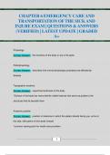
CHAPTER 6 EMERGENCY CARE AND TRANSPORTATION OF THE SICK AND INJURE EXAM | QUESTIONS & ANSWERS (VERIFIED) | LATEST UPDATE | GRADED A+
- Exam (elaborations) • 31 pages • 2024
- Available in package deal
-
- $10.99
- + learn more
CHAPTER 6 EMERGENCY CARE AND TRANSPORTATION OF THE SICK AND INJURE EXAM | QUESTIONS & ANSWERS (VERIFIED) | LATEST UPDATE | GRADED A+ Physiology Correct Answer: the functions of the body or any of its parts Pathophysiology Correct Answer: describes how normal physiologic processes are affected by disease Topographic anatomy Correct Answer: superficial landmarks of the body *Surface of the body has many definite visible features that serve as guides to the structures that lie be...
-
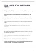
(OLD) LARE 2: STUDY QUESTIONS & TERMS WITH 100% CORRECT ANSWERS
- Exam (elaborations) • 31 pages • 2024
-
- $16.99
- + learn more
Abstract diagrams during the design process correct answersAttention can be focused on general issues and relationships Where would you design egg crate effect with freestanding walls? correct answersbest in hot, arid climates. Where would you use a 3' high jet in a 10' x 10' fountain? correct answersAs a focal point in an intimate garden. Contours on topographic survey are considered accurate to what? correct answersOne half the contour interval. On a contour map, swales or...

How did he do that? By selling his study resources on Stuvia. Try it yourself! Discover all about earning on Stuvia


