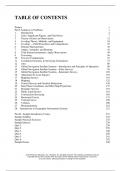
TABLE OF CONTENTS
Preface v
Part I: Solutions to Problems 1
1 Introduction 2
2 Units, Significant Figures, and Field Notes 7
3 Theory of Errors in Observations 12
4 Leveling Theory, Methods, and Equipment 18
5 Leveling — Field Procedures and Computations 25
6 Distance Measurement 36
7 Angles, Azimuths, and Bearings 42
8 Total Station Instruments; Angle Observations 49
9 Traversing 56
10 Traverse Computations 61
11 Coordinate Geometry in Surveying Calculations 73
12 Area 80
13 Global Navigation Satellite Systems—Introduction and Principles of Operation 90
14 Global Navigation Satellite Systems—Static Surveys 95
15 Global Navigation Satellite Systems—Kinematic Surveys 102
16 Adjustment by Least Squares 107
17 Mapping Surveys 119
18 Mapping 125
19 Control Surveys and Geodetic Reductions 130
20 State Plane Coordinates and Other Map Projections 137
21 Boundary Surveys 152
22 Public Land Surveys 161
23 Construction Surveying 165
24 Horizontal Curves 173
25 Vertical Curves 190
26 Volumes 200
27 Photogrammetry 210
28 Introduction to Geographic Information Systems 221
Part II: Sample Introductory Course 231
Sample Syllabus 232
Sample Practical Exercises 235
Sample Quizzes 239
Quiz 1 239
Quiz 2 239
Quiz 3 240
Quiz 4 240
Quiz 5 241
Quiz 6 242
Sample Exams 248
© 2018 Pearson Education, Inc., Hoboken, NJ. All rights reserved. This material is protected under all
copyright laws as they currently exist. No portion of this material may be reproduced, in any form
or by any means, without permission in writing from the publisher.
,Exam 1 248
Exam 2 251
Exam 3 253
Final Exam 255
© 2018 Pearson Education, Inc., Hoboken, NJ. All rights reserved. This material is protected under all
copyright laws as they currently exist. No portion of this material may be reproduced, in any form
or by any means, without permission in writing from the publisher.
, PART I:
SOLUTIONS TO PROBLEMS
© 2018 Pearson Education, Inc., Hoboken, NJ. All rights reserved. This material is protected under all
copyright laws as they currently exist. No portion of this material may be reproduced, in any form
or by any means, without permission in writing from the publisher.
, Instructor’s Solution Manual 2
Elementary Surveying: An Introduction to Geomatics
1 INTRODUCTION
NOTE: Answers for some of these problems, and some in later chapters, can be obtained by
consulting the bibliographies, later chapters, websites, or professional surveyors.
1.1 List 10 uses for surveying in areas other than boundary surveying.
Answers may vary many are included in Section 1.6, which lists control, topographic
hydrographic, alignment, construction, as-built, mine, solar, optical tooling, ground,
aerial, and satellite surveys. This list is not complete and could also include other types of
surveys such as hydrographic surveys, for example.
1.2 Explain the difference between geodetic and plane surveys.
From Section 1.4:
In geodetic surveys the curved surface of the earth is considered by performing the
computations on an ellipsoid (curve surface approximating the size and shape of the
earth). In plane surveys, except for leveling, the reference base for fieldwork and
computations is assumed to be a flat horizontal surface. The direction of a plumb line
(and thus gravity) is considered parallel throughout the survey region, and all measured
angles are presumed to be plane angles.
1.3 Describe some surveying applications in:
(a) Archeology
There are many different uses of surveying in archeology. Some include using sonar
to identify possible underground or underwater archeology sites, LiDAR to help
identify possible ancient human settlements in unexplored forest and jungles, and
traditional surveying and laser scanning to help locate artifacts in site excavations.
(b) Gas exploration
There are several stages of surveying in gas exploration, which include but are not
limited to determining anomalies in the gravity field, which identify possible gas
deposits, boundary surveys identifying properties that have mineral rights to the gas
deposits, alignment surveys for placement of pipelines to transport extracted gas.
(c) Agriculture
In agriculture, surveying is used to determine the acreage of fields, to locate lines of
constant elevation for strip farming, to track harvesting machinery to enable the size
of the harvest, and to track the position of the planting equipment to allow for precise
applications of seeds and fertilizers. The field is known as high-precision agriculture.
© 2018 Pearson Education, Inc., Hoboken, NJ. All rights reserved. This material is protected under all
copyright laws as they currently exist. No portion of this material may be reproduced, in any form
or by any means, without permission in writing from the publisher.


