Summary IEB Grade 12 GEOGRAPHY - Geomorphology - All Things Rivers
121 vues 3 fois vendu
Cours
Geography
Établissement
12th Grade
Book
Focus Geography
Forget too many pages of study notes, everything you need on rivers summarized into just 6 pages! One page per section makes it great to print out and keep in a file.
These notes are great for visual learners, and includes diagrams needed for explaining and describing.
This document is a summary of grade 12 geomorphology content of Geography
Geography Grade 12 - Summary: Climate and Weather
Tout pour ce livre (5)
École, étude et sujet
12th Grade
Geography
200
Tous les documents sur ce sujet (230)
Vendeur
S'abonner
kirstenms
Avis reçus
Aperçu du contenu
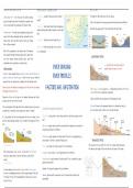
MPORTANT WATERSHEDS IN SA SURFACE RUNOFF & GROUND WATER WATER TABLE
Drakensberg Mtn – rivers flow down the eastern plateau Overland flow: rainwater flowing on surface (surface The height of water table varies with the seasons,
slopes into Indian Ocean from the Orange River system, which runoff)
Closer to the surface in the rainy season when there has been more infiltration.
rises in Lesotho and flows westwards into Atlantic Ocean Channel flow: erodes small streams that eventually join
together forming wider, deeper channels in which water Boreholes only supply water if they extend below the water table.
Witwatersrand – the high ground separating Limpopo River flows
system, which flows northwards and then eastwards into the
Indian Ocean, from Vaal River system, which joins Orange Through flow: infiltrate and flow through the soil
River & flows westwards
Groundwater: Water may percolate into permeable
Mtns of the escarpment on the southern side of the plateau rocks underground
that separate tributaries forming Orange River system from
the rivers draining southern plateau slopes, which flow Groundwater flow: underground water flowing below
southwards across coastal plain in southern Cape. surface
…In reality, there are many changes in
RIVER GRADING gradient along the course of a river
A river is termed ‘graded’ when a balance has been achieved between its
gradient, volume and channel shape, so that the river has just sufficient RIVER PROFILES
energy to flow, with erosion rates in balance with the deposition rates.
People can longitudinal
The ideal upset the balance
profile by
by building a dam across a river
of achanging any ofis concave
graded river these criteria, for due
in shape example
to a FACTORS INFL INFILTRATION The changes in gradient along river = as temporary base levels bc. the vertical
steeper gradient in the upper course and a more gradual gradient in the erosion of the river is slowed down temporarily.
lower course.will occur in the dam, as the gradient decreases and friction
Deposition Rapids, waterfalls, lakes and dams are all temporary base levels.
increases when the river enters the dam.
The river downstream of the dam will have less sediment and, as it now carries Sea level is known as the permanent base level or ultimate base level, as
FACTORS INFL.UENCING INFILTRATION this is the lowest level to which a river will erode the land.
a smaller load, it may have excess energy and so erode its channel.
It is also possible that the river downstream will have less volume, as the Precipitation: Heavy storms = more surface runoff, bc water flows quickly over the
water has been dammed upstream. This will reduce the energy level of the land.
river. Plant cover: greater surface runoff in areas where little vegetation to intercept the
precipitation and allow for infiltration.
Permeability: greater amounts of surface runoff if the rock is impermeable, as no
water unable to infiltrate + percolate through rocks.
OVER GRADED Porosity: the smaller the “pores/air space“ the less infiltration Also known as the cross-profile of a river. This is drawn transversely across
the valley at right angles to the river and shows the shape of the valley.
Rivers flowing down a steep gradient, or rivers with little friction bc Evaporation: max sunshine = more evaporation and less infiltration
they have a large volume or an even bed, have a great deal of
energy. Ground moisture: greater amounts of surface runoff if soil is saturated bc cannot
UNDER GRADED absorb any more water.
Therefore they can carry a heavy load and flow quickly. These
Ifrivers
volume decreases‘overgraded’,
are termed or the gradient lessens
as they haveorexcess
the friction
energy increases,
and will Gradient: the steeper the gradient the less infiltration
the
eroderiver
theiris channels.
undergraded, and does not have enough energy to flow and Suburbs: greater runoff in urban areas, as the concrete and tar surfaces are
to transport its load. As the undergraded river slows down, it deposits impermeable.
some of its load.
,PERMANENT RADIAL
Receive groundwater all year, Develops on a dome where streams flow outwards and downhill. This pattern looks
Water table always lies above the bed of the river. like the spokes of a bicycle wheel.
Groundwater that seeps into a river is called baseflow. TRELLIS
Forms on inclined strata that are unequally resistant to erosion, or in areas where
there are parallel fold mountains. Many streams develop on the softer strata or in
the valleys, with shorter tributaries joining the main streams at right angles.
PERIODIC RECTANGULAR
Only in the rainy season when the water table lies above the
riverbed. TYPES OF RIVERS Igneous rock that has joints and cracks gives rise to a rectangular drainage pattern.
Here, the streams develop right-angled bends where the joints meet.
These seasonal rivers only flow with baseflow for five to six months CENTRIPETAL
after a period of rain. SUPERIMPOSED The Vaal River, Crocodile River and Apies River
Streams flowing into a central pan or low-lying area develop a centripetal
A river develops its course, but over time the surface is eroded and the river pattern.
EPISODIC reaches older, underlying rocks.
Never supplied with underground water It is stream network displays a pattern that bears no relation to the geology and
relief of the landscape. DENDRITIC
Flow after an episode of rain; after a short thunderstorm,
they might flow for only a few hours. Impose: A force (an unwelcome decision or ruling) on someone take advantage Tributaries join larger streams at acute <‘s
of someone by demanding their attention or commitment.
if rain lasts longer period of time they become full, and can Forms on rocks of similar hardness in an area with a similar gradient. The
flow very quickly for a few days or a few weeks. rocks are massive igneous rock or horizontal layers of sedimentary rock.
It is stream network displays a pattern that bears no relation to the geology and Most common
EXOTIC relief of the landscape. PARALELL
Flow all year round ANTECEDANT The Indus Brahmaputra in Himalayas Develops on a surface that slopes uniformly but is fairly steep. The river and
its tributaries flow downslope nearly parallel to one another
Supplied with water from source but very little water is added as they Occurs where a river developed its course before the high-lying area was formed.
flow towards the sea. DERANGED
After the river formed, warping, folding or faulting occurred.
Rivers reflect the characteristics of their source region and not the Develop on a land surface that was covered by an ice sheet or glacier, but
region through which they are flowing If the rate of downcutting by the river was greater than the rate of uplift, the river that has since become exposed. The landscape is made up of small streams,
was able to maintain its pattern, cutting a gorge through the land that has been swamps and lakes. There is no apparent drainage pattern.
Nile River that flows all year, as it receives water from where it rises in lifted up.
the Ethiopian Highlands, but then flows through the Sahara Desert,
and so does not receive additional water. The course of the river is older than the more recent uplift of the land.
Antecedent: a thing that existed before or logically precedes another
, FLOW SPEEDS
STREAM ORDER RIVER DISCHARGE
Stream ordering indicates the number of tributaries in the basin and the Amount of water across the width of the river flowing past a point in a given time.
linking of the tributaries. A stream gauge measures the river’s discharge in cubic metres per second (cumecs).
The discharge figures of a river, during and after a rainstorm, are recorded on a storm
First-order streams are the lowest category, and are those channels with hydrograph, which indicates the rise in the river’s water during flooding.
no streams feeding them. Where two streams of the same order in a
What infl. discharge
network join, a stream of a higher order is formed.
Amount of rain Rock type
When two tributaries with same value Gradient of the land Vegetation
meet, the river levels up
Soil type Human activities.
2+2=3
When two tributaries with diff value
meet., the bigger wins
HYDROGRAPHS
2+ 3 = 3
DRAINAGE DENSITY DRAINAGE & FLOW
Total length of streams per unit area of a drainage basin.
Drainage density of an area may be described as low, medium, high or TYPES OF FLOW
very high.
Laminar flow - water flowing over a smooth surface, with little friction, flow
2
speeds can be great. The water flows in sheets and does not change levels.
Drainage basin A has an area of 30 km
Total length of rivers in the basin amounts to 120 km
Turbulent flow - water flowing in a bubbling motion. The river bed is uneven,
Make sure your measurement values are the same
FACTORS INFL. DRAINAGE DENSITY so the water continuously changes levels, which creates much internal
friction. This, together with the friction from the uneven bed, reduces the
High evapo. rates reduce the amount of runoff= a lower drainage density.
speed at which the water is flowing.
Regions with a high rainfall should have a high drainage density.
A large amount of infiltration leads to less runoff and a lower drainage density.
Hardness of the rock in the basin can affect the drainage density, as channels
will form more easily in areas with softer rock, and so the density will be higher.
Les avantages d'acheter des résumés chez Stuvia:
Qualité garantie par les avis des clients
Les clients de Stuvia ont évalués plus de 700 000 résumés. C'est comme ça que vous savez que vous achetez les meilleurs documents.
L’achat facile et rapide
Vous pouvez payer rapidement avec iDeal, carte de crédit ou Stuvia-crédit pour les résumés. Il n'y a pas d'adhésion nécessaire.
Focus sur l’essentiel
Vos camarades écrivent eux-mêmes les notes d’étude, c’est pourquoi les documents sont toujours fiables et à jour. Cela garantit que vous arrivez rapidement au coeur du matériel.
Foire aux questions
Qu'est-ce que j'obtiens en achetant ce document ?
Vous obtenez un PDF, disponible immédiatement après votre achat. Le document acheté est accessible à tout moment, n'importe où et indéfiniment via votre profil.
Garantie de remboursement : comment ça marche ?
Notre garantie de satisfaction garantit que vous trouverez toujours un document d'étude qui vous convient. Vous remplissez un formulaire et notre équipe du service client s'occupe du reste.
Auprès de qui est-ce que j'achète ce résumé ?
Stuvia est une place de marché. Alors, vous n'achetez donc pas ce document chez nous, mais auprès du vendeur kirstenms. Stuvia facilite les paiements au vendeur.
Est-ce que j'aurai un abonnement?
Non, vous n'achetez ce résumé que pour $7.39. Vous n'êtes lié à rien après votre achat.