Geog 360 - Study guides, Class notes & Summaries
Looking for the best study guides, study notes and summaries about Geog 360? On this page you'll find 6 study documents about Geog 360.
All 6 results
Sort by
-
GEOG 360 Midterm Exam | Questions with Verified Answers
- Exam (elaborations) • 14 pages • 2024
-
- $17.99
- + learn more
GEOG 360 Midterm Exam | Questions with Verified Answers Which of the following topological relationships describe the arc-node relationship in the coverage model? Connectivity Which of the following is true about the vector data model? -The model uses points, lines, and polygons to represent simple spatial features. -The representation of spatial features using the vector data model depends on map scale. -The model uses x-, y-coordinates to store the geometry of spatial features. Select the f...

-
GEOG 360 Midterm Questions and Correct Answers the Latest Update and Recommended Version
- Exam (elaborations) • 8 pages • 2024
-
- $10.49
- + learn more
Which of the following topological relationships describe the arc-node relationship in the coverage model? connectivity Which of the following is true about a line feature? A line connects two end points (nodes). A line feature is made of line segments (arcs). The shape of a line is defined by arcs connected by vertices. Topolgy is The spatial relationship between features on a map Multipart features are used to represent multiple geographic objects that represent parts of the...
-
GEOG 360 Midterm Exam | Questions with Verified Answers
- Exam (elaborations) • 4 pages • 2024
-
- $9.49
- + learn more
GEOG 360 Midterm Exam | Questions with Verified Answers Which of the following topological relationships describe the arc-node relationship in the coverage model? - Answer-connectivity /.Which of the following is true about a line feature? - Answer-A line connects two end points (nodes). A line feature is made of line segments (arcs). The shape of a line is defined by arcs connected by vertices. /.Topolgy is - Answer-The spatial relationship between features on a map /.Multipar...
-
GEOG 220 NOTES THE HUMAN ENVIRONMENT -PLACE SPACE AND IDENTITY (CONCORDIA UNIVERSITY) COMPLETE 2023 STUDY REVIEW SOLUTION
- Summary • 11 pages • 2023
- Available in package deal
-
- $8.49
- + learn more
GEOG 220 NOTES THE HUMAN ENVIRONMENT -PLACE SPACE AND IDENTITY (CONCORDIA UNIVERSITY) COMPLETE 2023 STUDY REVIEW SOLUTION GEOG 220 The human environment: Place, Space, and Identity The evolution of human geography: Part 1 THE BEGGININGS Geography definition: - An interest in knowing where we are - An interest describing the characteristic of our world - A knowledge of who/what lies beyond our world...
-
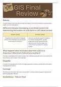
Study Guide for Final GEOG 360 GIS Fundamentals
- Class notes • 6 pages • 2023
-
- $7.99
- + learn more
This document was inspired by the study guide given to students to study for the final exam in the course. The content reviews Chapters 1 through 14 concepts in the textbook "GIS Fundamentals: A First Text on Geographic Information Systems" by Paul Bolstad.
-
A Beginners Guide to ArcGIS
- Summary • 11 pages • 2023
-
- $17.99
- + learn more
This document briefly explains the basics of navigating and maneuvering in the ArcGIS software for the GIS: GEOG Information Systems and Theory course. The class had us create a notebook guide if we needed reminders on how to use the software outside of class. In other words, this guide can be used whenever you need a refresher on the basics of ArcGIS. It describes how to open a project, add data, edit features, create maps, create layouts, access Geoprocessing Tools, and work with symbo...

$6.50 for your textbook summary multiplied by 100 fellow students... Do the math: that's a lot of money! Don't be a thief of your own wallet and start uploading yours now. Discover all about earning on Stuvia


