Plane surveying - Study guides, Class notes & Summaries
Looking for the best study guides, study notes and summaries about Plane surveying? On this page you'll find 84 study documents about Plane surveying.
Page 3 out of 84 results
Sort by
-
Surveying Exam 3 questions and answers graded A+
- Exam (elaborations) • 3 pages • 2024
- Available in package deal
-
- $9.99
- + learn more
Surveying Exam 3Surveyors Measure - correct answer Horizontal angles, vertical angles, horizontal distances, slope distances, vertical distances, elevation differences Leveling - correct answer way to determine elevation of points, differences in elevation Leveling produces data for - correct answer Mapping, construction, Engineering design Vertical Line - correct answer Line that follows the local direction of gravity as indicted by a plumb line Level Surface - correct answer Curved...
-
Surveying FS Instruments and Procedures, Geodetic Control Systems, and GPS Question and answers 2023/2024 verified to pass
- Exam (elaborations) • 3 pages • 2023
- Available in package deal
-
- $13.49
- + learn more
Surveying FS Instruments and Procedures, Geodetic Control Systems, and GPS Question and answers 2023/2024 verified to pass How does plane surveying differ from geodetic surveying? - correct answer the way it treats the curvature of the earth. Plane surveying is conducted on a horizontal plane while geodetic surveying takes the curvature into account What is the Standard railroad gauge within the United States? - correct answer 4' 8.5" What is a miner's inch? - correct answer a rate of ...
-
CVEN 303 Final Exam Questions with 100% Correct Answers (A+ Graded)
- Exam (elaborations) • 24 pages • 2023
- Available in package deal
-
- $14.79
- + learn more
What does GIS and GNSS stand for Correct Answer Geographic Information Systems, Global Navigation Satellite Systems conversion Correct Answer 1m = 3, ft 1ft = .3048m 0.36v = 1ft 1chain = 66ft 80chain = 5280ft 1mi = 5280ft 1rod = 16.5 ft 1ac = 43560 ft^2 5280' x 5280' = 640 ac 1 nautical mi = 6076.12 ft 1 fathom = 6 ft types of Professional Surveying Correct Answer RPLS, LSLS, PLS, Land Boundary, Topographic, engineering, photogrammetry, hydrography, mining, construction, geospa...
-
Surveying Test 1 (Ch 1-6)correctly answered graded A+ 2024/2025
- Exam (elaborations) • 4 pages • 2024
- Available in package deal
-
- $9.99
- + learn more
Surveying Test 1 (Ch 1-6) types of taping errors (know 3) - correct answer pull (P), temperature (N), tape length (I), sag (N,P), alignment (P), tape not level (P), plumbing (P), marking (P), interpolation (P) *error source I= instrumental, N= natural, P= personal measuring distance - correct answer measuring an unknown distance between fixed points (finding distance) methods of measuring distance (know 4-5) - correct answer pacing, taping, satelite systems (GPS), tacheometry (stadia...
-
Surveying Final questions well answered 2024
- Exam (elaborations) • 6 pages • 2024
- Available in package deal
-
- $12.99
- + learn more
Surveying FinalThe conformity of a measurement to the "true" Value. - correct answer Accuracy post construction survey that confirms design execution and records in-progress revisions - correct answer as-built (final) survey a surveyor's level in which line of sight is maintained automatically in the horizontal plane, once the instrument is roughly leveled - correct answer automatic level the direction of a line, measured clockwise (usually) from North meridian - correct answer azimu...
-
AC Exam - Construction Geomatics with 100- correct answers
- Exam (elaborations) • 10 pages • 2024
-
- $14.99
- + learn more
Which of the following pieces of equipment does not measure vertical angles? A. builder's level B. theodolite C. transit D. robotic total station A. builder's level What type of telescoping rod is often used with levels, transits, and total stations? A. Alachua rod B. Leon rod C. Pinellas rod D. Philadelphia rod D. Philadelphia rod How many feet are in 1 mile? A. 12 B. 100 C. 5,280 D. 12,000 C. 5,280 If a 1,000-ft road has a vertical rise of 10 ft what perce...
-
Land Surveying question n answers graded A+
- Exam (elaborations) • 5 pages • 2024
- Available in package deal
-
- $11.49
- + learn more
Land SurveyingSurveying - correct answer the art of taking field measurements on or near the surface of the Earth Plane Surveying - correct answer ignores the curvature of the Earth for horizontal dimensions Geodetic Surveys - correct answer Curved (ellipsoidal) shape of the Earth Total Station - correct answer distances and angles (electronically), computation of x, y, z position and electronic storage of data. Theodolite - correct answer horizontal and vertical angles and alignment...
-
Surveying Final Question and answers 100% correct 2023/2024
- Exam (elaborations) • 6 pages • 2023
- Available in package deal
-
- $13.49
- + learn more
Surveying Final Question and answers 100% correct 2023/2024The conformity of a measurement to the "true" Value. - correct answer Accuracy post construction survey that confirms design execution and records in-progress revisions - correct answer as-built (final) survey a surveyor's level in which line of sight is maintained automatically in the horizontal plane, once the instrument is roughly leveled - correct answer automatic level the direction of a line, measured clockwise (usually...
-
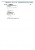
Solutions for Algebra and Trigonometry, 5th Edition by James Stewart
- Exam (elaborations) • 952 pages • 2023
-
- $29.49
- + learn more
Complete Solutions Manual for Algebra and Trigonometry 5e 5th Edition by James Stewart, Lothar Redlin, Saleem Watso. Full Chapters Solutions are included - Chapter 1 to 13 P. PREREQUISITES. Chapter Overview. P1. Modeling the Real-World with Algebra. P2. The Real Numbers. P3. Integer Exponents and Scientific Notation. P4. Rational Exponents and Radicals. P5. Algebraic Expressions. P6. Factoring. P7. Rational Expressions. P8. Solving Basic Equations. P9. Modeling with Equations. Chapter P Revi...
-
Surveying Exam Questions with Verified Answers
- Exam (elaborations) • 3 pages • 2024
- Available in package deal
-
- $10.49
- + learn more
Surveying is a learned, licensed, self-policing profession dealing primarily with _ measurement and _ law - Answer-land 7 types of surveying - Answer-topographic, hydrographic, route, property, final, aerial, and construction Surveying is a _ regulated in every state by a _ board - Answer-profession, governing NCEES is a national nonprofit organization dedicated to advancing professional _ for engineers and surveyors - Answer-licensure Plane surveying assumes a fixed _ datum as part ...

$6.50 for your textbook summary multiplied by 100 fellow students... Do the math: that's a lot of money! Don't be a thief of your own wallet and start uploading yours now. Discover all about earning on Stuvia


